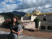
It seems like Central America has some of the wettest areas and driest areas in the world. The vegetation is remarkly variable as a result.
Tuesday, April 20, 2010
Beaches
Its been a few 2 months since I updated here. Sorry for the absence, its partially because I´ve had more to do when working and partially due to time in Canada. In the next week or so I am planning to add quite a few fotos and catch up on Costa Rica and Nicaragua. I´m back in Honduras right now for 2 or 3 months (probably 3 as there are classes to teach in June and Honduras is in the World Cup (soccer) for the first time in 28 years, so June looks to be very interesting here!). I plan to travel quite a bit in the time, as well as working in Tegucigalpa.
---------------------------------------------------------------------------------
So far I have only made it to the Pacific coasts of the countries I´ve visited in Central America. The Pacific beaches are rockier with bigger waves and don´t have the bright blue calms waters of the Carribean.

Costa Rica coastline

Sunsets along the Costa Rica coastline

Sunsets along the Costa Rica coastline

Pure gold sunset along the Costa Rica coastline
And the last sunlight of 2009 for CostaRica:

In Nicaragua, most of the beaches have very few people and amazing areas to walk and explore.


The tides pools at this beach area in Nicaragua were full of an amazing array of sea life and we spent a lot of time exploring.


Wednesday, January 13, 2010
Managua - as U2 said ¨where the streets have no names¨
Here is the house I live in, from the street.

From behind the front wall, here is the front of the house and looking through from the front towards the back. The house is surrounded by a large patio/coutyard with a number of sitting areas and small gardens.


This is my room

And the living room looking through to the backyard. As you can see the house is somewhat open to the outside.


And a close of the security wires and broken bottles common at the tops of the walls in most neighbourhoods (common to all but the poorest).

This is the only picture I have right now of the slums. These are the worst areas of Managua and are just areas of squatters.

Almost all the streets in Managua (except for probably 8 major streets) have no names. This make maps not very useful and navigation only possible if you sort of know where you are going before you go. My address is "por la Universidad Evangelical de Nicaragua, 2 cuadras al sur (south), 3.5 cuadras arriba (up, which means east)" or "de donde fue la casa de Meija Godoy (where the house of Meija Godoy used to be), 2 cuadras abajo (down, west), 1.5 cuardas al lago (towards the lake)". The father in my house is fond of saying Managua is the largest village in the World.
Although Managua is the capital city, there is very little of tourist interest to see here. The city experienced a large earthquake in 1972 (1 day before Christmas) and almost all the city center was destroyed and not rebuilt. For this reason, there are very few buildings taller than 1 storey and the city is very spread out. I have heard that what happened in Haiti yesterday (January 12) is likel very reminiscent of the destruction here.
This is the view from the highest point in central Managua , the Loma de Tiscapa (a hill beside a volcanic laguna) looking north including Lake Managua. The tall building is a hotel and I think the only tall building survive the earthquake.

Looks south from the Loma across the Laguna de Tiscapa, the rest of Managua is visible. There are an amazing amount of trees here and the city is basically hidden in them. I live close to the tall blue building visible on the horizon, about 1/4 of the way in from the left side of the photo (and in the lower photo). In the lower photo, the new catherdral is visible(looking moorish or boobish) and the mall closest to my house (with red lettering). Where the hills are in the distance, through the clouds in this photo, is Volcan Masaya, the closest volcano (about 20 km) which is active and continues to emit dust and smoke.


On the Loma is a large statue of Sandino that can be seen from almost everywhere in the city:

The old cathedral also survived somewhat and stills stands, although is unsafe for people to enter.

Subscribe to:
Posts (Atom)

